
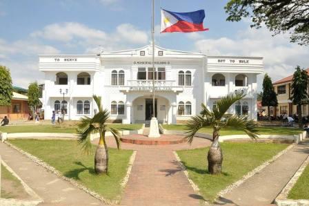
LGU BRIEF PROFILE
HISTORY
Pinamungahan (also spelled Pinamungajan) is a second income class municipality in the province of Cebu, Philippines. According to the 2014 census, it has a population of 57,997 people.
The municipality was established in the 1815 under the Spanish colonial government in the country. The municipality got its name from the diligent and hardworking people, working hand in hand especially during the agricultural harvest season. “Pinamungajan”, which originated from the Visayan word Pinamuhuan, meaning a worker share for his effort during a farm harvest. Over time the Pinamungajan eventually changed to the current name of the municipality.
GEOGRAPHICAL LOCATION
The Municipality of Pinamungajan is located in the southwestern part of the province of Cebu. It is 70 kilometers away from the provincial capital, Cebu City, and can be reached by land transportation via Naga-Uling Road.
Pinamungajan shates its political boundaries with the following: on the north, by the City of Toledo; on the northeast by the Municipality of Naga, on the south by the municipality of Aloguinsan, on the southeast by the municipalities of San Fernando and Carcar, and on the west by Tañon Strait.
LAND AREA
Pinamungajan, which is composed of 26 barangays, has a total land area of 11, 725.27 hectares.
WEATHER / CLIMATE
Pinamungajan’s climate falls under the third type. This type has no pronounced season. Wet and Rainy days could happen any time of the year. Relatively, however, rainy days usually occur during the months of May to October and the rest of the year could be dry. The area is partly sheltered from the northeast monsoon and trade winds but open to the southwest monsoon that brings in most of the storm.
Municipality of Pinamungajan
Geographical Location
The Municipality of Pinamungahan is 65 kms. southeast of Cebu City. It is bounded on the South by the Municipality of Aloguinsan; on the North by the City of Toledo; on the East by the Municipalities of Naga and San Fernando; oand on the East by Tañon Strait.
Class:
Annual Income: (as of )
No. of Barangays:26
Total Land Area (Cadastral Survey): 11, 725.27
Land Classification as of ()
· Arable Area – 1, 447.00 Has.
· Residential – 265.00 Has.
· Commercial – 1, 687.00 Has.
· Industrial – 3, 063.00 Has.
· Certified Alienable/Disposable Land – 3,950.77 Has.
· Classified Forest/Reservation/Timberland – 523.00 Has.
· Wildlife/Military Reserve Land – 200.00 Has.
· Unclassified Forest Land/Wilderness – 587.00 Has.
· National Park/Playground – 2.00 Has.
Topography:
Generally mountainous and hilly with steep ridges. Rocky mountains are visible at the central portion of the mountain.
Climate:
Third Type of no pronounced season, dry from January to May and wet for the rest of the year.
Soil Type:
Hydrosol Beach sand Faraon Clay Lugo Clay Faraon clay steep phase Mandaue clay loam Bolinao clay
Demography:
Population: (Latest NCSO Survey-2012) 61, 831
No. of Household: 12, 593
Labor Force: 19, 000
Infrastructure and Utilities Road Network
National Road: 11.00 kms.
Provincial Road: 15.00 kms
Municipal Road: 8.14 kms
Barangay Road: 59.384 kms.
Ports (Domestic/International):
Airport (if any):
Schools (Public & Private)
Elementary: 24
High School: 6
College: 1
Public Library: 2
Multi-purpose Building: 25
Reacreation Courts/Centers: 20
Transportation Services
No. of Buses: 17
No. of Jeepneys: 47
No. of Tricycle: 49
No. of Trisikads: 61
Communication:
No. of Post Office: 1
No. of Telephone Stations: 1
No. of Telex Services: 1
No. of Telegraphic Stations: 1
Power
Source of Electricity: CEBECO
No. of Barangay Served: 10
No. Household Served: unaccounted
Water
Source of Water: Mun. Water System
No. of Households Served:
Cost per M3 Commercial Residential:
0-10 P 140.00
0-10 P 70.00
11-20 14.00
11-20 7.00
21-30 15.40
21-30 7.70
31-above 18.20
31-above 9.10
Financial Intermediaries
No. of Commercial Banks and Money Shops: None
No. of Government Banks: None
No. of Savings Banks: None
No. Rural Banks: 1
No. of Lending/Financing Institutions: 1
No. of Cooperative within the area: 16
Trade and Industry
Commercial Establishments
Type of Business No. of Establishments
Sari-sari Store - 212
Restaurants & Cafeterias - 20
Fresh Fish & Meat Retailers - 22
General Merchandising - 2
Service and Repair Shops - 7
Tailoring & Dress Shops - 4
Pawnshops & Lending Investments- 1
Lumber and Hardwares - 3
Pharmacies and Drug Stores - 1
Marketing Firms(Appliances, furniture, etc – 1
Gasoline Station - 2
Bakeries - 5
Photo Shops & Beauty Parlors- 1
Others (Pls. Specify)
Raw materials available within area:
Types of Materials
1. Root Crops
2. Corn
3. Banana
4. Siapo
5. Legumes
6. Rice
7. Fish/Prawn farms
8. Coco Midribs
9. Vegetables
10. Coconut
11. Tikog
12. Bamboo
Livestock and Poultry
(Names of existing Commercial farms within the area)
1. Baricuatro Poultry
2. Carvellida Poultry
3. Malusay Poultry
4. Tellidua Poultry
5. Intong Poultry
6. L. Alpas Poultry
7. P. Gepitulan Poultry
8. Cuaycong Poultry
9. E. Yapha Livestock
10. Tangarorang Livestock
Existing Skills
Ø Welding
Ø Hi-speed Sewing
Ø Carpentry
Ø Plumbing
Ø Masonry